
Fire Burns in Northern Italy
Downloads
- italy_olitir_2019056_detail.jpg (720x480, JPEG)
- italy_olitir_2019056_lrg.jpg (4096x4096, JPEG)
Metadata
- Sensor(s):
- Landsat 8 - OLI
- Landsat 8 - TIRS
- Data Date: February 25, 2019
- Visualization Date: February 25, 2019
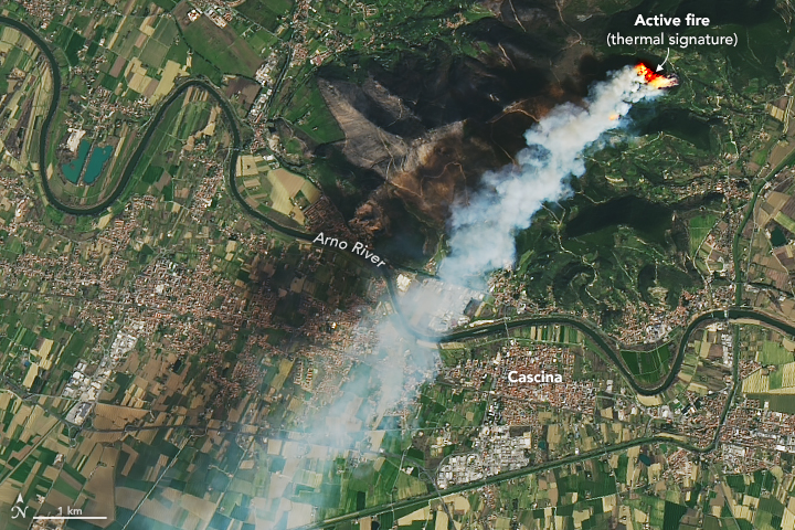
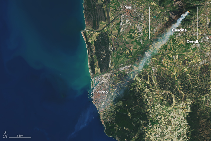
On the morning of February 25, 2019, a fire on the slopes of Monte Pisano sent smoke billowing across the western Italian coast. Reports estimate at least 180 hectares (less than 1 square mile) of forest and vegetation have been burned.
The Landsat 8 satellite acquired these images on February 25, 2019, around 10:58 a.m. local time, approximately thirty minutes after the fire commenced. Both images are a combination of natural color (bands 4-3-2) and infrared (band 10), which was used to highlight the active fire.
News outlets report that the event started from a bonfire that spread due to strong winds. People were evacuated from the nearby village of Vicopisano, located on the slopes of Monte Pisano.
References and Further Reading
- Adnkronos (2019, February 25) Rogo in pineta, evacuate case a Vicopisano. Accessed February 25, 2019.
- Cascina Notizie (2019, February 25) Continua a bruciare il Monte Pisano nel comune di Vicopisano, il fuoco provocato da un abbruciamento maldestro ed imprudente. Accessed February 25, 2019.
- Pisa Today (2019, February 25) Incendio Monte Serra: l'innesco da un rogo di sterpaglie. Accessed February 25, 2019.
- Pisa Today (2019, Febraury 25) Incendio sul Serra: il monte brucia ancora. Accessed February 25, 2019.
NASA Earth Observatory images by Joshua Stevens, using Landsat data from the U.S. Geological Survey. Caption by Kasha Patel.
This image record originally appeared on the Earth Observatory. Click here to view the full, original record.