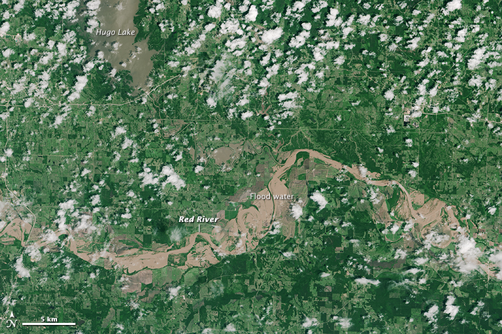
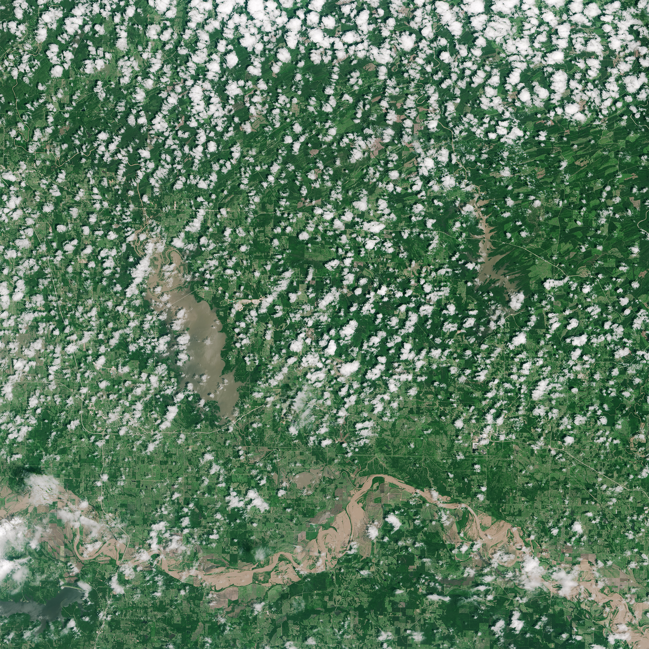
acquired May 26, 2015
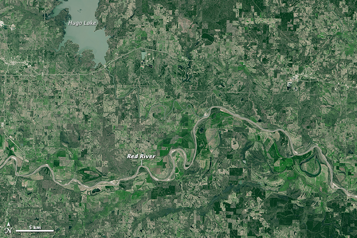
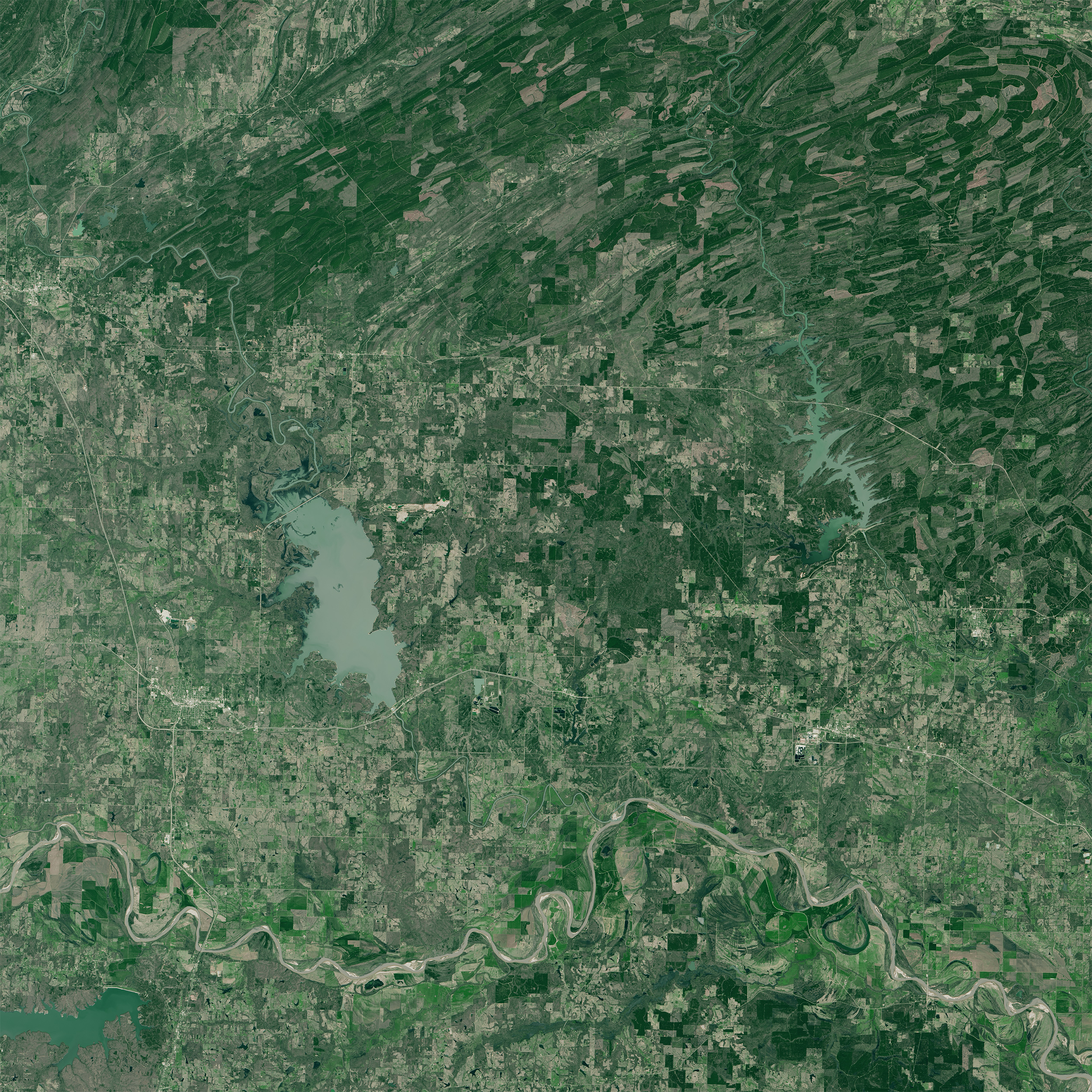
acquired March 23, 2015
Flooding of The Red River
Downloads
- redriver_oli_2015146_lrg.jpg (2500x2500, JPEG)
- redriver_oli_2015082_lrg.jpg (2500x2500, JPEG)
Metadata
- Sensor(s):
- Landsat 8 - OLI
- Data Date: March 23, 2015 - May 26, 2015
- Visualization Date: May 29, 2015
On May 26, 2015, the Operational Land Imager on the Landsat 8 satellite acquired a natural-color image of flooding along the Red River, which forms part of the state border between Texas and Oklahoma. For comparison, the same area is also shown on March 23, 2015.
NASA Earth Observatory images by Joshua Stevens, using Landsat data from the U.S. Geological Survey. Caption by Mike Carlowicz.
This image record originally appeared on the Earth Observatory. Click here to view the full, original record.