acquired December 19, 2000
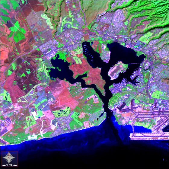
Pearl Harbor, Hawaii
Downloads
- Pearl_Harbor_742.tif (1804x1804, TIFF)
- Pearl_Harbor_321.tif (1804x1804, TIFF)
Metadata
- Sensor(s):
- Landsat 7 - ETM+
- Data Date: December 19, 2000
- Visualization Date: January 8, 2010
Pearl Harbor is located on the southern shore of the island of Oahu on the Hawaiian Island chain. The harbor was made infamous on December 7, 1941 when a Japanese air raid destroyed much of the U.S. Navy battleship force. Today, Navy and Air Force facilities still occupy the majority of Pearl Harbor's shoreline. The Honolulu International Airport can be found in the lower right portion of this image.
This Landsat 7 image was acquired on December 19, 2000. It uses ETM+ bands 7, 4, and 2. Urban areas appear in purple hues and vegetation appears bright green. Pearl Harbor falls on Landsat WRS-2 Path 65 Row 45.
NASA GSFC Landsat/LDCM EPO Team