acquired March 28, 2002
Carrizozo Malpais
Downloads
- Carrizozo_Malpais.tif (3144x3144, TIFF)
Metadata
- Sensor(s):
- Landsat 7 - ETM+
- Data Date: March 28, 2002
- Visualization Date: November 23, 2009
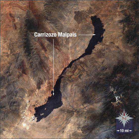
The Carrizozo Malpais is a 47-mile long lava flow located in south-central New Mexico. It is a remnant of the Holocene Epoch and one of the longest know lava flows from that period. It is approximately three miles in width at its widest and 0.6 miles in width at it’s narrowest. In this Landsat 7 image the dark brown almost black feature in the middle is Carrizozo Malpais. It is surrounded by desert in brown.
This Landsat 7 image was acquired on March 28, 2002. This is a natural-color image using ETM+ bands 3, 2, and 1. Carrizozo Malpais falls on Landsat WRS-2 Path 33 Row 37.
NASA GSFC Landsat/LDCM EPO Team