Snowshoe Lava Field
Downloads
- snowshoelavafield_oli2_2023299_lrg.jpg (2805x1870, JPEG)
Metadata
- Sensor(s):
- Landsat 9 - OLI-2
- Data Date: October 26, 2023
- Visualization Date: December 28, 2023
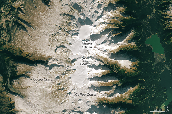
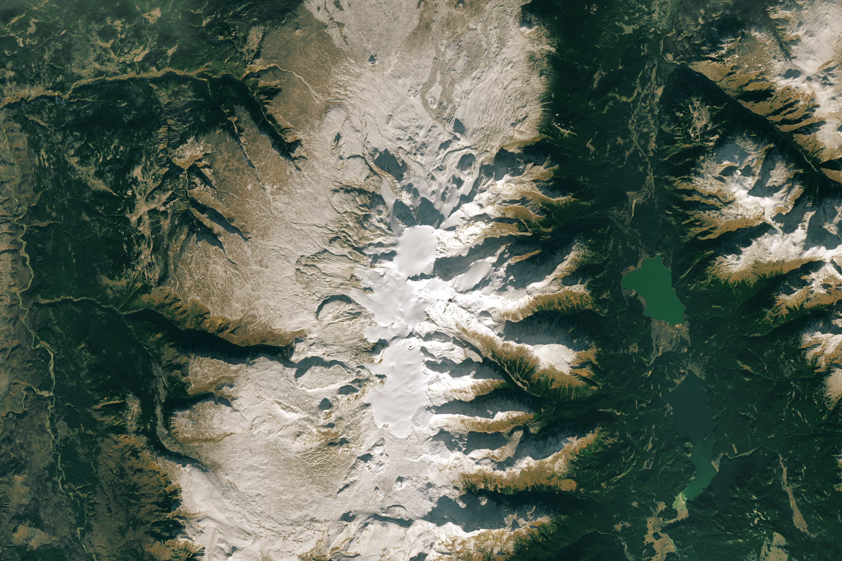
Pack some winter footwear and a couple of hot beverages for this volcanic tour in northwestern Canada. The Snowshoe Lava Field, with landmarks such as Coffee Crater and Cocoa Crater, is part of the Mount Edziza volcanic complex in British Columbia. The stratovolcanoes, cinder cones, and lava domes in this area were created in a series of eruptive cycles over several million years.
The OLI-2 (Operational Land Imager-2) on Landsat 9 captured this image of the Snowshoe Lava Field and the surrounding volcanic terrain on October 26, 2023. The stratovolcano Mount Edziza, with its ice-filled summit caldera, formed around 1 million years ago. At 2,786 meters (9,140 feet) in height, Edziza is one of Canada’s tallest volcanoes. Its slopes were a source of obsidian that was traded regionally as early as 10,000 years ago.
The Snowshoe Lava Field, extending south and southwest from Ice Peak, is among the younger features in the Mount Edziza volcanic complex; it formed in the most recent volcanic cycle within the past 20,000 years. Several cinder cones punctuate its basaltic expanse, including Coffee Crater and Cocoa Crater, whose names reflect their rich brown hues. In this autumn scene, though, a dusting of white snow obscures the color of the rock.
This land of lava is a remote wilderness area within Mount Edziza Provincial Park. There is no vehicle access to the park, so adventurers can only access it via floatplane or on foot. The land supports wildlife such as moose, caribou, and grizzly bears, and is culturally significant to the Tahltan Nation.
Geologists are also interested in the area’s lava flows that cooled underneath or alongside glacial ice. In studying the characteristics of ice-cooled lava, for example, they might better estimate the past ice thickness in other volcanic regions on Earth. It may even help in deciphering the climatic and geologic history of Mars, where scientists have found evidence that lava interacted with water or ice.
References
- BC Parks Mount Edziza Provincial Park. Accessed December 21, 2023.
- Global Volcanism Program Edziza. Accessed December 21, 2023.
- Hungerford, J.D.G., et al. (2014) Evolution of a subglacial basaltic lava flow field: Tennena volcanic center, Mount Edziza volcanic complex, British Columbia, Canada. Journal of Volcanology and Geothermal Research, 272, 39-58.
NASA Earth Observatory image by Michala Garrison, using Landsat data from the U.S. Geological Survey. Story by Lindsey Doermann.
This image record originally appeared on the Earth Observatory. Click here to view the full, original record.